Transbay Blog
This page will be updated, most likely without notice, as necessitated by changes to project funding status or other pertinent developments. Additionally, here is a list of links to Transbay Blog posts that include more detail on both the Regional Transportation Plan adopted in 2009 (“Transportation 2035”) and the next RTP update, forthcoming in 2013:
Just Say No to Roads, 14 Jul. 2008
Can MTC Take the Heat?, 29 Jul. 2008
Planning for Climate Change, 8 Sep. 2008
Getting Somewhere on Land Use, 12 Sep. 2008
Can MTC Take the Heat? Redux, 6 Oct. 2008
Shifting Funds, Shifty Priorities, 26 Mar. 2009
Regional HOT lane network going back to the drawing board, 8 Jul. 2010
When commitment isn’t a virtue, 13 Apr. 2011
A missed opportunity, and the shortcomings of regional planning, 28 Apr. 2011
For more information on development of the Bay Area’s Sustainable Communities Strategy — a new component of the RTP required under Senate Bill 375 — please see the SB 375 Archives.
—

Transportation 2035; courtesy of MTC.
The Metropolitan Transportation Commission — the regional agency which plans and oversees transportation in the nine counties that touch the shores of San Francisco Bay — is preparing Transportation 2035, which is the latest update to the Regional Transportation Plan that allocates funding to regional transportation for the next twenty-five years. The funds that are used to operate, maintain, and expand the Bay Area’s transportation network comes from sources that are local, state, and federal in origin. MTC expects that over the course of the next twenty-five years, a total of $226 billion will be made available to the Bay Area to apply to transportation. The RTP, using as a basis the regional growth forecasts prepared by the Association of Bay Area Governments, maps out how that money is to be invested in a way that (ideally, anyway) supports MTC’s goals to reduce traffic congestion, improve air quality, increase inner ring density, and encourage transit use, bicycling, and carpooling.
The $226 billion sum is further divided into “committed” funds — about $194 billion worth that MTC has previously reserved, or which is required by law to be used for specific purposes — and “discretionary” funds, which account for the remaining $32 billion. The $226 billion may also be divided according to three broad purposes: operations and maintenance, system efficiency, and expansion. Ironically, although the RTP is subtitled “Change in Motion,” the plan is primarily preoccupied not with change, but with merely maintaining the current system. About $166 of the $226 billion is devoted to operations and maintenance, $20 billion for increasing system efficiency, and the remaining $40 billion to be applied to network expansion. Of the expansion money, $30 billion is slated for transit expansion, while about $10 billion is allocated for roadway “improvements” that include freeway widening and fixing interchanges. When all is said and done, MTC allocates about two dollars to transit for each single dollar it allocates to roads.
Transit Expansion:
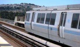 The RTP allocates some $30 billion toward the Regional Transit Expansion Program, pursuant to MTC’s 2001 Resolution 3434. But — at the risk of sounding a bit cynical — where do we truly stand on Resolution 3434’s transit expansion portfolio? The plan is anchored by a few especially costly rail projects whose planning flaws make one doubt our investment choices. VTA has had a chronically difficult time lining up funds to cover the ever-escalating price tag (currently at $7.6 billion) for BART to San Jose. The claimed effectiveness of San Francisco’s Central Subway under 4th and Stockton Streets is something we have looked at here before, in which we concluded there was serious reason to doubt that it will deliver $1.6 billion worth of benefit. There is also eBART, a $525 million train through the remote auto-oriented sprawl of Contra Costa County east of BART’s current terminus at Pittsburg/Bay Point, a project about which we will have more to say on a later date. There have also been plans to build people movers that would better link Oakland and San Jose Mineta airports to existing and planned transit systems. For awhile, both projects were put on hold indefinitely, and that’s still true of San Jose. But the languishing Oakland Airport Connector, despite its many flaws (including decreased ridership projections and lack of intermediate stations) has been put on the fast-track to take advantage of ARRA stimulus funds; but a funding gap remains, even including the federal money.
To be sure, there are also some good projects included in the “committed” list — including the Transbay Transit Center; upgrades, improved service and infill stations for the Capitol Corridor; Caltrain electrification, which has been delayed for years, will at least occur in connection with high-speed rail; and also SMART commuter rail, the region’s cheapest major transit project that will restore passenger rail to the last major part of the Bay Area that currently lacks it. Dumbarton Rail, and the planned intermodal station at Union City that Dumbarton Rail would serve, are also included — nominally, at least, given MTC’s refusal to maintain a dedicated funding stream to the project. In September 2008, MTC snatched $91 million of Regional Measure 2 bridge toll funds that were to be applied to Dumbarton Rail, and tentatively reallocated the money to the 5.4-mile, $890 million BART extension to Warm Springs — a springboard to BART to Silicon Valley. This decision was formalized following a January 2009 hearing , on the ground that BART to Warm Springs was “ready to go,” while Dumbarton Rail was not. Arguably, the committed bus rapid transit corridors (San Francisco’s Van Ness Avenue, and the East Bay’s Telegraph Avenue/East 14th Street 1R Corridor) — are two of the better projects on the list; a combination of committed and discretionary funds is also allocated to bus rapid transit on Geary and Geneva in San Francisco.
Meanwhile, although the plan purports to look ahead deeply into the 21st century, it commits no funds toward planning a transportation link that, although very expensive, may prove to be the single most important in upcoming decades: an additional tube under the Bay to increase transbay capacity. Anyway: yes, MTC has plans to allocate lots of money to transit expansion, and much more, it turns out, to transit than to freeway expansion. This is a good thing, but not a magic bullet — for we will not get our money’s worth if a great deal of that money has been committed to big-ticket projects that may not carry their weight in terms of getting more people on transit, reducing vehicle miles traveled, and curbing greenhouse gas emissions. Of course, we would love nothing more than to be proven wrong about that. In any case, transit expansion is a frequent topic of discussion on this site — so rather than devote more space to it here, interested readers are encouraged to read further postings devoted to these projects.
System Efficiency:
In addition to transit expansion, the RTP applies funds to various other programs and initiatives that the efficiency of our transportation system, including the $1.6-billion Freeway Performance Initiative, 511.org, the Transit Connectivity Plan — and of course the fabled TransLink smart card, whose regionwide implementation has been a bumpy road, to put it mildly. MTC, often at the insistence of dedicated transit and livability advocates, now allocates discretionary and committed efficiency funds towards other initiatives that help to address the RTP’s pillars of “economy, equity, environment.” These include the Lifeline Transportation Program, which focuses on low-income mobility issues; initaitives related to global warming, like the Climate Grants Program and the Transportation Climate Action Campaign; Safe Routes to Transit/Safe Routes to Schools, which faciliate pedestrian and bicycle access to transit routes and schools; the Transit Priority Program, which focuses on incremental improvements to bus amenities; and the $2.2-billion Transportation for Livable Communities program that provides funding to support pedestrian improvements and smart land use.
Regional Bicycle Network: The RTP allocates $1 billion of discretionary funding toward the Regional Bicycle Network, which is a planned 2,140-mile network (currently half-built) that includes bike lanes on streets, dedicated bike paths, and the Bay Trail. Although the network includes bicycle lanes on all eight of the Bay Area toll bridges, the RTP does not yet include the additional $400 million that would be needed to complete the entire network — including missing bicycle access to the San Mateo Bridge, the Richmond-San Rafael Bridge, and the western span of the Bay Bridge. (Bicycle access on the Bay Bridge’s new east span, under construction, is absorbed into that project’s construction cost.) Incidentally, although the remaining bridge bicycle lanes will comprise only 1% of the total network mileage, they are fully half the total cost. The most costly expansion — but perhaps also one of the most important symbolically — is for the Bay Bridge’s west span, where less than two miles of bicycle lane represents over one-third of the network’s total cost.
Bridge Construction & Seismic Retrofits:
The Bay Area’s bridges range from beloved photogenic landmarks to merely functional roadways. They can be serious traffic choke points, and, as we have become keenly aware of since the 1989 Loma Prieta earthquake, they are also crucial regional lifelines — in part because bridge construction in the first instance all but extinguished the Bay Area’s once-thriving network of ferry connections. All eight of the region’s toll bridges have been (or will be) seismically retrofitted, and the scope of retrofitting ranges from mere structural strengthening to outright replacement of the span. As noted above, another long-term plan is to integrate once automobile-dominated bridges into the region’s bicycle network; bicycle access has already been completed for the Antioch, Benicia-Martinez, Carquinez, Dumbarton, and Golden Gate Bridges.

Rendering of the forthcoming Bay Bridge east span; courtesy of Caltrans.
The most significant retrofit activity in progress is for the San Francisco-Oakland Bay Bridge, which was damaged in the Loma Prieta earthquake and was closed for one month after the earthquake for repairs. Although lesser known to visitors than the Golden Gate, this workhorse of the Bay Area’s bridges carries about 265,000 cars each day, making it one of the world’s most heavily traveled bridges. The west span was retrofitted in 2004, and the west approach is being retrofitted, which has necessitated a few carefully-orchestrated bridge closures. But the most substantial and visible part is construction of the $6.3-billion new eastern span, a rendering of which is pictured directly above. We need not repeat here the torturous design and to-date construction history of this structure — except to mention a controversy from the past year regarding the inadequate welded panels manufactured by Shanghai-based Zhenhua Port Machinery Company, and possible nonchalance on the part of Caltrans in altering its standards to expedite bridge completion before the Bay Area’s next big earthquake. If Caltrans and ZPMC can compensate for the delay on the tower construction, the new single-deck self-anchored suspension span will replace the current double-decker in the year 2013, complete with bicycle and pedestrian access.
Fifteen miles to the south of the Bay Bridge, the San Mateo-Hayward Bridge, which is the longest in the Bay Area, was retrofitted in 2000 and then widened in 2003. Before 2003, the western portion of the bridge rising above the shipping channel was six lanes wide, but the low-rise trestle portion was only four lanes wide, creating a traffic bottleneck; but since 2003, the bridge has six lanes for its full length. The Richmond-San Rafael Bridge has been retrofitted, and the Golden Gate Bridge must still complete its third and last phase of a $700-million retrofit. In August 2007, a $1.3-billion five-lane span opened to carry northbound traffic for the Benicia-Martinez Bridge. The original three-lane span from 1962, which now carries southbound traffic, has been retrofitted and is planned to be widened to include a high-occupancy toll lane and bicycle access. (Sandwiched between those two spans is the oldest in this trio of bridges: Union Pacific’s rail bridge, built by Southern Pacific in 1930, which carries Capitol Corridor trains and freight traffic.) In November 2003, a new four-lane westbound span for the Carquinez Bridge opened as a memorial to local ironworker Alfred Zampa, and it was California’s first suspension bridge since the Bay and Golden Gate Bridges were completed in the 1930s. This 2003 bridge was built to replace the seismically unsafe 1927 bridge, which was the Bay Area’s first notable bay crossing. The 1927 span was demolished in 2007, but it temporarily carried eastbound traffic during the retrofit of the 1958 span, which carries four lanes of eastbound traffic. Finally, the Antioch Bridge is due for a $313-million retrofit; and the Dumbarton Bridge, whose west approach was widened to six lanes in 2004, is due for a $650-million retrofit. A $1 toll increase expected to take effect in 2010 will supply necessary funding.
In addition to transit expansion, bridge work, and bicycle/pedestrian and efficiency projects, the Transportation 2035 plan also commits about $10 billion to expanded roads and freeways — this despite MTC itself pointing out that attempting to build our way out of congestion is a non-starter. Although many of these projects are relatively cheap, some are quite major — and in any case, the list of roadway “improvements” goes on for literally pages, while the number of major transit expansion projects can be counted on maybe two or three hands. Many projects, both transit and roadway, have been on the books for years as “committed” projects, carried through each subsequent iteration of the RTP under the assumption that they are still worth building. Out of a $226 billion total package, $10 billion for roadway expansion is admittedly a small percentage. But perhaps the main lesson to draw away from the RTP is this: even though $226 billion sounds like a lot of money for just the 7,179-square mile corner of the globe known as the Bay Area, it is still not enough — particularly when such a vast amount of resources must be directed at simply operating and maintaining the status quo. We still must set goals, and prioritize funding that accomplishes those goals. Knowing what we do about induced demand and the way that freeways degrade air quality, congestion, human health, and the nearby environment, do we really want to allocate any more money to expanding their width or reach? Or should the focus instead be to merely maintain the road system as it currently exists? According to MTC’s own surveys, 65% of the Bay Area voiced their concern that climate change was an “extremely important” issue, and only 7% found climate change to be altogether unimportant. MTC also acknowledges that the Bay Area public has issued a “mandate for change” — but sometimes, we wonder how closely the agency is listening. What follows is a summary of some of the major roadway projects to which MTC intends to commit funding.
High Occupancy Toll (HOT) Lane Regional Network:
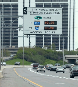
HOT lane on I-394 in Minneapolis; courtesy of MTC.
Bay Area freeways currently have many stretches of carpool lanes whose comparatively swift traffic is intended to entice solo drivers to carpool, but the temptation might be greater still if the lane were to remain continuous, completely removing carpools and buses from traffic bottlenecks. MTC plans to resolve this difficulty — sort of, but its traffic management tool of choice is the high-occupancy toll (HOT) lane, rather than high-occupancy vehicle (HOV) lanes. A rather small, but much-touted, portion of Transportation 2035 is MTC’s plan to create an 800-mile regional network of HOT lanes, implemented in phases through the year 2025. (The first segments — I-580 through the Tri-Valley, and a 14-mile stretch of I-680 over the Sunol Grade — are anticipated to open in 2010.) This would create an almost-seamless regional network — there would still be a few gaps, including, quite notably, US 101 between San Francisco and SFO, and I-880 in Oakland. While solo drivers are restricted from driving in HOV lanes, they would be permitted to use HOT lanes by paying a toll via FasTrak readers. In order to maintain smoothly flowing traffic in HOT lanes, the toll would vary based on the demand for the roadway at that time, using data collected from roadway sensors. The lanes would be free of charge for buses and carpools. Although HOT lanes are sometimes disdainfully dubbed “Lexus Lanes” by opponents who believe they are only used by the wealthy, studies have shown drivers of all income levels use them. Washington State recently instituted HOT lanes on Route 167 between Renton and Auburn, where it was discovered that the most common vehicle make that paid tolls was Ford, followed by Chevrolet, Toyota, and Honda. And HOT lanes may actually encourage drivers to switch to carpool. I-15 in San Diego, for example, experienced a 53% increase in carpools since the debut of a HOT lane on that freeway.
However, MTC’s plan to complete this regional network would not only refashion existing High Occupancy Vehicle (HOV) lanes into HOT lanes, but it would also fund the construction of brand-new HOT lanes to fill in gaps in the network (or new HOV lanes that would thereafter be converted for use as HOT lanes), and in the process, widen many stretches of freeway throughout the region. If we absolutely must widen freeways at all, a HOT lane is preferable to a normal traffic lane. But another method is to convert an existing traffic lane into a HOT lane, which may provide extra incentive for drivers to carpool or shift mode; it would theoretically increase the freeway’s capacity and generate revenue, without the larger expense and other negative effects associated with paving new lanes. At any rate, MTC has postulated that $6.1 billion of net positive revenue might be captured over 25 years, more than recovering the $7.6 billion construction, finance, and operation cost. Toll revenue from any given corridor would then be applied toward transit and roadway improvements in that corridor.
Smaller sums of money — usually on the order of $20 to 40 million per segment — will be spent to convert existing HOV lanes for use as HOT lanes. The primary expense then stems from those freeways and interchanges which MTC plans to be widened in connection with implementing the HOT lane network, of which there are a substantial number in the works. $579 million of widening is planned in Alameda County along I-580, between I-680 and San Joaquin County. $768 million would cover HOT lane projects along I-80 in Solano County, and $669 million would fund HOT lane upgrades to Highway 101 in San Mateo and Santa Clara Counties; further cheaper upgrades are planned for I-280 and Route 237 in Santa Clara County. Completing HOV lanes in Marin and Sonoma Counties, including the notorious Novato Narrows bottleneck, and then outfitting those lanes for use as HOT lanes, will cost close to $1 billion. And $1.1 billion of widening is also planned for various segments of I-680: between Route 84 and Milpitas, in Walnut Creek, and near the Benicia-Martinez Bridge.
Other Freeway Expansion:
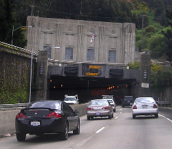
Caldecott Tunnel; courtesy of Flickr user jenser.
No HOT lanes are planned for the Route 24 corridor — so the controversial $446 million fourth bore of the Caldecott Tunnel that connects Oakland and Orinda cannot even be justified on the HOT lane premise; it would just be an old-fashioned freeway widening. The Caldecott Tunnel first opened in 1937 with twin 3,610-foot bores; at that time, it was known as the Broadway Low-Level Tunnel, because pre-freeway, the tunnel was accessed via the northeastern segment of Broadway in Oakland. The northern third 3,771-foot bore was added to the complex in 1964; thereafter, the trio of tunnels became a proper freeway linked to the new Grove-Shafter Freeway. Under the current configuration, the middle of the three bores switches direction daily to accommodate peak traffic flow, triggering traffic backup in the reverse commute direction. Adding the fourth bore would create four permanent lanes in each direction to match the eight lanes of Highway 24, doubling the tunnel’s capacity for the reverse commute direction. The Caldecott Tunnel Fourth Bore Coalition (which includes as members the North Hills Phoenix Association, the Rockridge Community Planning Council, and the East Bay Bicycle Coalition) filed a CEQA challenge against Caltrans; the City of Oakland had also filed suit, but then settled with Caltrans in 2008 for $8 million worth of mitigation. In December 2008, in light of the state budget crisis, the Pooled Money Investment Board voted to suspend Proposition 1B funds that were to be applied to projects across the Bay Area and California; included among those funds was $194 million allocated toward the Caldecott Tunnel fourth bore. Although the fourth bore is on hold because of the funding gap, Governor Schwarzenegger included the Caldecott Tunnel as a project that he would exempt from CEQA to make it “shovel ready” for federal stimulus money — a suggestion for which Democratic legislators have not, to date, shown much enthusiasm.
Aside from the HOV widening, the HOT Lane Network, and the Caldecott Tunnel, MTC has committed funding to scores of roadway “improvement” projects across the region, including widening certain roads and ramps, auxiliary lanes, and upgraded freeway interchanges. Many of these projects are relatively cheap when taken alone, but the cost adds up when we consider the whole collection. And some individual projects are not even particularly cheap: Along I-880, the reconstructed Route 92 interchange under construction will cost $245 million, and the I-880/Mission improvements will cost $243 million. Widening the notorious I-238 bottleneck to six lanes between I-580 and I-880 will cost $123 million, and a new connector to I-880 will cost $160 million. Improvements to Cordelia Junction (the I-80/I-680/Route 12 interchange) in Solano County will cost $488 million. In Santa Clara County, an improved I-880/I-280/Stevens Creek interchange will ring up $150 million; widening portions of the Central, San Tomas, Montague, and Almaden Expressways will cost $167 million; and an improved Route 237/Route 85 interchange could cost $95 million. In San Mateo County, auxiliary lanes mostly added to a few spots along Highway 101 could sum to over $450 million, to say nothing of other potential interchange upgrades. The above list is illustrative, but hardly exhaustive. It goes on: but should it? Although some roadway widening and improvement projects are carried out with the goal of increasing the reach of HOV/HOT lanes, a great many of these projects are widening for the sake of widening, having the underlying goal of increasing roadway capacity and easing the experience of motorists — even though congestion relief is bound to be short-lived. These projects do not incentivize commuters to shift travel mode from solo driving; rather, they promote further sprawl, which does not comport with MTC’s more recently-expressed interest in curbing climate change.



Comments are closed.